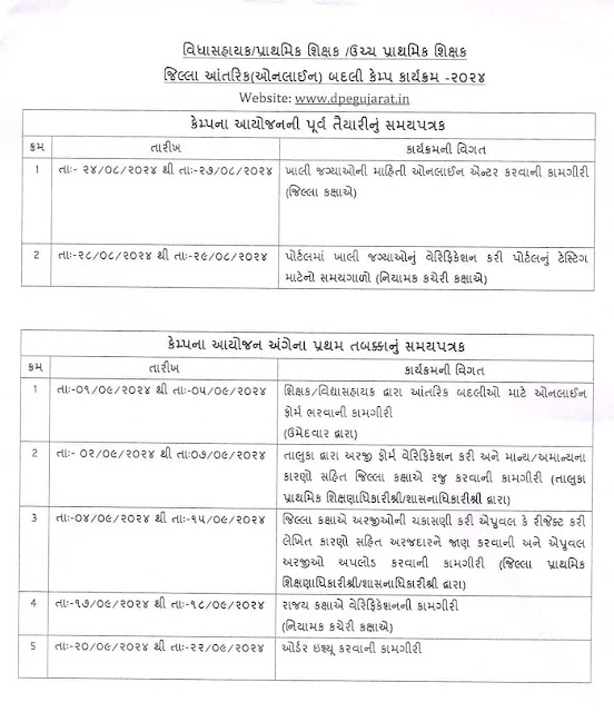
Dhoran and vishay vehchani babate niyamak Shri no paripatra see here
CLICK HERE FOR VIEW AND DOWNLOAD
CLICK HERE FOR VIEW AND DOWNLOAD
Aaj ka gyan
In late September 2010, a wide band of disturbed weather and low pressure, associated with the monsoon trough and remnant tropical moisture from Tropical Storm Matthew, meandered over the northwestern Caribbean Sea.[3] With a broad upper ridge anchored along the Yucatáncoast, diffluence aloft in the vicinity of the disturbance provided focus for the development of scattered convection.[4] The National Hurricane Center (NHC) noted an environment supportive of tropical development, and by September 27, a broad surface low formed amid the convection.[5]The next day, surface pressures steadily dropped as sustained winds around the low proximated tropical storm force.[6]Throughout the development process, moderate westerly wind shear over the region caused the disturbance to exhibit a rather asymmetric structure;[1] it developed an elongated low-pressure center by September 28, well to the northwest of its strongest wind field.[7] Despite the asymmetry, the NHC initiated advisories on a tropical depressionaround 15:00 UTC that day, after surface and satellite observations revealed a sufficiently defined circulation center west of the deep convection.[8] Post-season reassessments, however, indicated that a tropical storm had, in fact, formed three hours earlier, about 75 miles (120 km) south of Cuba's Isle of Youth, which operationally was not named Nicole until a day later


